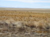
...on the High Plains of NE Colorado. My friend Larry and I decided it was too nice a day not to take a ride. We wanted to go the mountains, but weren't sure what it would be like in the area where the Cameron Pike and Troublesome Fires have burned. Heavy snow at the first of last week and lower wind in the mountains have given the fire teams time to extend their control, and I think all the roads up there are open, but we decided to do our 140-mile loop out northeast of Greeley to Briggsdale on CO-392 and then north on County Road 77 to the nearly-dead little town of Hereford, east on County Road 136 and then south on CR89 to the bigger and more prosperous town of Grover.
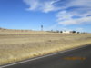
Northbound on CR77 with the northern end of the Front Range of the Rocky Mountains in view 80-90 miles west of us.
Curves!! Basically rare on the high plains. These are about 8 miles north of Grover.
When we left Greeley at 11AM, it was 57F, but by the time we got up the road just a little, the temperature had soared to 70. By the time we made Grover, it was 80F! I had started off wearing my Aerostitch Wind Blocker Fleece under my 'Stitch R-3 and we didn't stop till Grover. By then, I was sweating!
Grover isn't growing, but it seems stable for now. My wife, Joanne, lived there in the late 60s while her first husband was doing field research for his PhD in ornithology to write his thesis on mountain plovers. The town is close to a huge and still-growing wind farm and workers there are living in Grover. Some of them rent houses and a lot live in an RV park there. There is some oil field work, but right now there isn't any drilling going on, and maintaining existing wells doesn't take a lot of people.
Larry and I ate at the Grover Market and Restaurant, which serves pretty good burgers. The market isn't very big but when you wander around their aisles, the way they meet a lot of needs for a town that's 50-60 miles from anywhere else to shop. They've got hardware, building materials, a good range of groceries, meat, even some electronics. There's a library, a nice school (because of tax income from the wind farm and oil field) that services a bunch of farms and a huge geographical area but only has 80 students K-12. The school is highly rated although not too many kids from there go on to college.
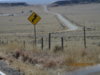
Keota, CO, on County Road 390.
South of Grover, CR390 has only recently been paved. It follows a straight line from Hereford to Keota (the SW gateway to Pawnee Buttes) and on to CO-14. That line was made by a railroad spur that originated in Cheyenne. When it was gravel, it was heavily washboarded due to a lot of trucks cutting off from 14 to shorten the trip to Cheyenne. I only rode it once, avoiding it partly because of the washboard which would beat you up and partly because of the dust and gravel thrown up by the trucks. I did drive it a few times when going to meetings in Cheyenne and was lucky never to have a windshield broken! One of the interesting pieces of history about Keota involves a young man who grew up there in the teens and '20s. He took the train to Cheyenne and got a job with the Union Pacific. He had only finished 9 or 10 grades of school but was a bright, energetic, ambitious man who by the late '30s had become the President of the Union Pacific Railroad.
On our way home, from Grover we followed CR390 to CO-14 and could see what at first just looked like nice clouds. But, alas, as we went west on 14, we could tell that we were also seeing smoke. As far as I could tell there was only a little smoke from the Cameron Peak Fire, NW of Ft Collins, but quite a bit more from the Troublesome Fire, which is the one that ran into RMNP and has destroyed several hundred homes. As we rode under the smoke, the temperature dropped to about 75.
I won't get another chance to ride this week and next week looks like it's going to bring winter temps to stay. :-(
Here's a link to my Spotwalla track. I recommend viewing in Spotwalla's hybrid view: https://spotwalla.com/tripViewer.php?id=24db55fa2175bae6a0&hoursPast=0&showAll=yes
Northbound on CR77 with the northern end of the Front Range of the Rocky Mountains in view 80-90 miles west of us.
Curves!! Basically rare on the high plains. These are about 8 miles north of Grover.
When we left Greeley at 11AM, it was 57F, but by the time we got up the road just a little, the temperature had soared to 70. By the time we made Grover, it was 80F! I had started off wearing my Aerostitch Wind Blocker Fleece under my 'Stitch R-3 and we didn't stop till Grover. By then, I was sweating!
Grover isn't growing, but it seems stable for now. My wife, Joanne, lived there in the late 60s while her first husband was doing field research for his PhD in ornithology to write his thesis on mountain plovers. The town is close to a huge and still-growing wind farm and workers there are living in Grover. Some of them rent houses and a lot live in an RV park there. There is some oil field work, but right now there isn't any drilling going on, and maintaining existing wells doesn't take a lot of people.
Larry and I ate at the Grover Market and Restaurant, which serves pretty good burgers. The market isn't very big but when you wander around their aisles, the way they meet a lot of needs for a town that's 50-60 miles from anywhere else to shop. They've got hardware, building materials, a good range of groceries, meat, even some electronics. There's a library, a nice school (because of tax income from the wind farm and oil field) that services a bunch of farms and a huge geographical area but only has 80 students K-12. The school is highly rated although not too many kids from there go on to college.
Keota, CO, on County Road 390.
South of Grover, CR390 has only recently been paved. It follows a straight line from Hereford to Keota (the SW gateway to Pawnee Buttes) and on to CO-14. That line was made by a railroad spur that originated in Cheyenne. When it was gravel, it was heavily washboarded due to a lot of trucks cutting off from 14 to shorten the trip to Cheyenne. I only rode it once, avoiding it partly because of the washboard which would beat you up and partly because of the dust and gravel thrown up by the trucks. I did drive it a few times when going to meetings in Cheyenne and was lucky never to have a windshield broken! One of the interesting pieces of history about Keota involves a young man who grew up there in the teens and '20s. He took the train to Cheyenne and got a job with the Union Pacific. He had only finished 9 or 10 grades of school but was a bright, energetic, ambitious man who by the late '30s had become the President of the Union Pacific Railroad.
On our way home, from Grover we followed CR390 to CO-14 and could see what at first just looked like nice clouds. But, alas, as we went west on 14, we could tell that we were also seeing smoke. As far as I could tell there was only a little smoke from the Cameron Peak Fire, NW of Ft Collins, but quite a bit more from the Troublesome Fire, which is the one that ran into RMNP and has destroyed several hundred homes. As we rode under the smoke, the temperature dropped to about 75.
I won't get another chance to ride this week and next week looks like it's going to bring winter temps to stay. :-(
Here's a link to my Spotwalla track. I recommend viewing in Spotwalla's hybrid view: https://spotwalla.com/tripViewer.php?id=24db55fa2175bae6a0&hoursPast=0&showAll=yes
Last edited: