PRE-RALLY PREPARATION
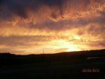
I had a good ride from Greeley up to Big Sky, Montana. I "enjoyed" the high winds that are one of the great attractions of riding on an interstate highway in Wyoming, and then was in rain, intermittently from Bondurant to Hoback Junction, and then steadily until I was nearly down to the bottom of Teton Pass on the Idaho side. I spent a good night in Driggs, WY, and enjoyed a really good dinner at Agave, a new Mexican food place in Driggs.
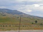
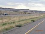
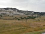
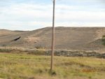
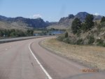
Riding north from there to West Yellowstone took me through beautiful wheat country, pine forests, and then into the mountains of northwest Yellowstone National Park before arriving at Big Sky Mountain Resort. It's an incredible setting -- a really nice hotel with all sorts of recreational amenities, surrounded by gorgeous homes nestled below magnificent mountains. I guess somebody has to live in places like that. I'm just grateful that there seem to be enough brave souls to fill the need.
We had a pig roast on Thursday night and I knew I was in trouble for the Rally when I couldn't find the pig roast for nearly an hour. When I did find it, the pig was a carcass (but I managed to cut off enough meat that I didn't starve). There was also one roll left and I got about three bites of fruit. But I got to meet people I've admired for their riding and strategizing in rallies I've read about over the years. Nobody played any ego games and the Big Dogs were funny and perfectly willing to give useful advice to us noobies.
Friday was as day to get through registration. Everyone had to have a SPOT tracker and get it registered on the Rally tracking link. People who didn't already have a SPOT could borrow one for the Rally. After that, there was a registration form that we filled in with Name, Address, Emergency Contact Info, etc.
Then we went to the bike where our license, registration, and insurance cards were checked. As far as I know, everyone got through this, but some people had to struggle to find and read their VIN # on their bike. They had to match the registration and insurance documents.
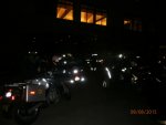
The Odometer check began when a Rally Staff person had us line up our front axle with a mark on the ground, zero our trip meter and wrote down the odometer reading. Then, we rode down to the highway, turned right and rode to and through a parking lot at a local steakhouse and then back up the mountain. There, the staff person checked the trip meter mileage (mine was 21.4) and that was used to calculate an odometer correction factor. (Since at the finish, my odometer read 1,800 miles more than it had on Saturday morning at 3:30AM when our odometers were checked again, if I had needed more than 1,800 miles to finish that correction factor could have been critical.)
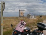
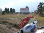
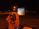
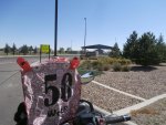
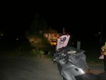
After the odometer check, we went to the registration room to receive our Rally Flags each with our Rider ID # (mine was "50"), and the bonus locations, and to hear the Routemaster, Jeff Earls, explain how the rally worked. Jeff is a perennial Iron Butt Rally contender who has finished as high as 2nd place in the Big Dance. He's also an engineer and that was evident in the ride options.
We were "Working on the Railroad," and railroads move freight. In the Big Sky country, those freights are usually ore, timber, crops. We each had "trains" with four cars. We'd pick up cargo and each cargo would fill one car. The cargos each had an assigned value that reflected the difficulty of picking it up. Difficulty generally rose the farther the cargo pickup was from Big Sky. Then each cargo had a adjustment factor that differed according to the location of the station it was delivered to. Coal, for example, wouldn't have been worth much delivered to a station in Gillette, WY (if there had been a station there). For Beginners like me, the adjustment factors weren't in play. We got full value for each cargo no matter where we took it. But for the Experienced riders, those factors could make a huge difference -- they ranged from a low of .4 to a high of 1.6.
Unfortunately, when I had started working with Base Camp the night before, I learned that my computer and my GPS weren't talking to each other. To make things even worse, I couldn't talk to my GPS -- it wouldn't let me enter a new route.
I used Streets and Trips to plan a ride to stations mostly east of Big Sky. One of the bonuses was a special freight which would be carried between Minot AFB (Minot, ND) and Malmstrom AFB (Great Falls, MT). The train had to be empty before picking up the freight in Minot and we couldn't pick up any other freight until we got to Malmstrom. That cargo was worth over 6,000 points, and since us noobs needed 8,000 points to be finishers, it was central to my strategy.
I planned a route and then started trying to enter it into my GPS. The bonus cards each had GPS coordinates and sample pictures of photos that would be sufficient to document our cargo pickup (or delivery). After entering all the locations I planned on visiting six times and then not being able to save them, I was at wit's end (which isn't very far from where I live all the time). Finally, I had an idea that worked. I opened an existing trip, deleted all it's destinations, and entered my coordinates, renamed the route. That worked! I was in bed by midnight. I finally went to sleep around 1:30. I had my alarm set for 2:45 because we had to be down to get our bikes into starting position by 3:00. So, well rested with an hour and 15 minutes sleep, I was up and ready to go!
I had a good ride from Greeley up to Big Sky, Montana. I "enjoyed" the high winds that are one of the great attractions of riding on an interstate highway in Wyoming, and then was in rain, intermittently from Bondurant to Hoback Junction, and then steadily until I was nearly down to the bottom of Teton Pass on the Idaho side. I spent a good night in Driggs, WY, and enjoyed a really good dinner at Agave, a new Mexican food place in Driggs.
Riding north from there to West Yellowstone took me through beautiful wheat country, pine forests, and then into the mountains of northwest Yellowstone National Park before arriving at Big Sky Mountain Resort. It's an incredible setting -- a really nice hotel with all sorts of recreational amenities, surrounded by gorgeous homes nestled below magnificent mountains. I guess somebody has to live in places like that. I'm just grateful that there seem to be enough brave souls to fill the need.
We had a pig roast on Thursday night and I knew I was in trouble for the Rally when I couldn't find the pig roast for nearly an hour. When I did find it, the pig was a carcass (but I managed to cut off enough meat that I didn't starve). There was also one roll left and I got about three bites of fruit. But I got to meet people I've admired for their riding and strategizing in rallies I've read about over the years. Nobody played any ego games and the Big Dogs were funny and perfectly willing to give useful advice to us noobies.
Friday was as day to get through registration. Everyone had to have a SPOT tracker and get it registered on the Rally tracking link. People who didn't already have a SPOT could borrow one for the Rally. After that, there was a registration form that we filled in with Name, Address, Emergency Contact Info, etc.
Then we went to the bike where our license, registration, and insurance cards were checked. As far as I know, everyone got through this, but some people had to struggle to find and read their VIN # on their bike. They had to match the registration and insurance documents.
The Odometer check began when a Rally Staff person had us line up our front axle with a mark on the ground, zero our trip meter and wrote down the odometer reading. Then, we rode down to the highway, turned right and rode to and through a parking lot at a local steakhouse and then back up the mountain. There, the staff person checked the trip meter mileage (mine was 21.4) and that was used to calculate an odometer correction factor. (Since at the finish, my odometer read 1,800 miles more than it had on Saturday morning at 3:30AM when our odometers were checked again, if I had needed more than 1,800 miles to finish that correction factor could have been critical.)
After the odometer check, we went to the registration room to receive our Rally Flags each with our Rider ID # (mine was "50"), and the bonus locations, and to hear the Routemaster, Jeff Earls, explain how the rally worked. Jeff is a perennial Iron Butt Rally contender who has finished as high as 2nd place in the Big Dance. He's also an engineer and that was evident in the ride options.
We were "Working on the Railroad," and railroads move freight. In the Big Sky country, those freights are usually ore, timber, crops. We each had "trains" with four cars. We'd pick up cargo and each cargo would fill one car. The cargos each had an assigned value that reflected the difficulty of picking it up. Difficulty generally rose the farther the cargo pickup was from Big Sky. Then each cargo had a adjustment factor that differed according to the location of the station it was delivered to. Coal, for example, wouldn't have been worth much delivered to a station in Gillette, WY (if there had been a station there). For Beginners like me, the adjustment factors weren't in play. We got full value for each cargo no matter where we took it. But for the Experienced riders, those factors could make a huge difference -- they ranged from a low of .4 to a high of 1.6.
Unfortunately, when I had started working with Base Camp the night before, I learned that my computer and my GPS weren't talking to each other. To make things even worse, I couldn't talk to my GPS -- it wouldn't let me enter a new route.
I used Streets and Trips to plan a ride to stations mostly east of Big Sky. One of the bonuses was a special freight which would be carried between Minot AFB (Minot, ND) and Malmstrom AFB (Great Falls, MT). The train had to be empty before picking up the freight in Minot and we couldn't pick up any other freight until we got to Malmstrom. That cargo was worth over 6,000 points, and since us noobs needed 8,000 points to be finishers, it was central to my strategy.
I planned a route and then started trying to enter it into my GPS. The bonus cards each had GPS coordinates and sample pictures of photos that would be sufficient to document our cargo pickup (or delivery). After entering all the locations I planned on visiting six times and then not being able to save them, I was at wit's end (which isn't very far from where I live all the time). Finally, I had an idea that worked. I opened an existing trip, deleted all it's destinations, and entered my coordinates, renamed the route. That worked! I was in bed by midnight. I finally went to sleep around 1:30. I had my alarm set for 2:45 because we had to be down to get our bikes into starting position by 3:00. So, well rested with an hour and 15 minutes sleep, I was up and ready to go!

")